


Navstar - GPS & Map for Hikers app for iPhone and iPad
Developer: Josue V. Herrera
First release : 18 Dec 2018
App size: 11.02 Mb
Navstar process and segment the raw data your device (GPS receiver) is getting from the satellite network. This data complements many of the features that Navstar offer, the following:
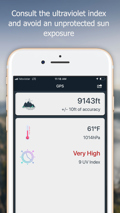
Inside the GPS tab
- Altitude from sea level, with the correction of the device barometer.
- Temperature and atmospheric pressure. (Touching the icon updates the value)
- UV (Ultraviolet) Index shows you the risk of harm from unprotected sun exposure. (Touching the icon updates the value)
- Compass with 32 points of references.
- Visual guidance (a cute little ball) that moves around the compass and always points to the geographical coordinates where the hike started.
- Geolocation: country, city, and province.
- Coordinates in different formats.
- You can take a screenshot of your current altitude and location.
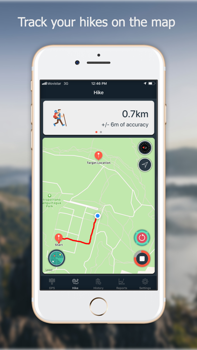
Inside the Hike tab
- Track your hike in the map.
- The distance traveled is updated in real-time.
- The elapsed time.
- The current speed.
- You can delimiter your hike inside a circular safe zone, and the app warns you when you enter or exit this zone.
- Touching a map annotation shows the coordinates for that location with the option to share it with apps like Waze, Google Map, or just plain text.
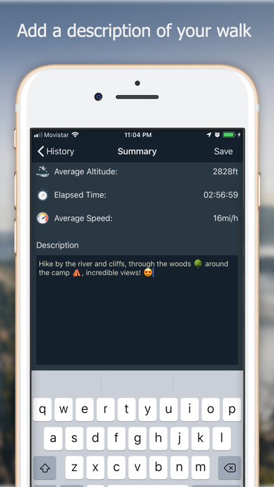
- When the hike is over the app shows you a summary of your walk, where you can add a description and choose to save it or not.
Inside the History tab
- List of all your saved hikes.
- You can delete a hike.
- You can edit a hike and change the associated description.
- You can load a hike and visualize it in the map (at the Hike tab) including the distance traveled and rest of information.
Inside the Reports tab
- A summary of the distance and top altitude you have covered and reach during your saved hikes.
- A graphical comparison between all your saved walks, segmented in the last seven days, the current month and a custom date range you can choose.
- You can also take a screenshot of these reports in a simple way.
Inside the Settings tab
- You can customize units and formats.
- You can customize the magnetic declination.
- You can customize the type of the map from Standard, Satellite, or Hybrid.
- You can enable or disable the visual guidance on the GPS tab.
- You can choose from two of the available algorithms used to measure the distance covered during your hikes.
- You can prevent the screen from auto-lock when using Navstar.
- The “About” section where you can know a litter more about me and contact me if you wish.
That’s all for now, folks. I want you to know that your feedback is essential to us. You can send your comments and suggestions through the “About” section inside Navstar, and also to:
navstar [at] swiftbycoding [dot] dev
or
@NavstarApp at Twitter
If you are enjoying the app, please leave us a rating and a review here at the App Store. Thank you!